Geocoding & Location Intelligence
Say hello to “X marks the spot” global location accuracy
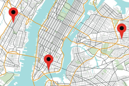
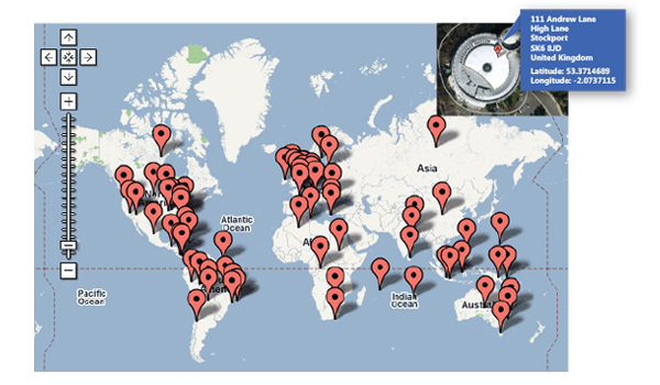
Melissa GeoCoder solutions convert addresses into geocodes (latitude and longitude coordinates), which you can use to place markers on a map, or position the map. Our unique address parsing and matching algorithms help GeoCoder fix spelling errors and complete addresses that have missing or invalid components to provide more precise results. In addition to rooftop (highly precise) geocoding, we have other levels of accuracy to meet every need and budget.
- Get precise, plotted coordinates to improve logistics and decrease shipping costs
- Power retail store location and local search lookups to increase customer satisfaction and ease of shopping
- Get real-time geocoding in 240+ countries around the world to power more effective business intelligence
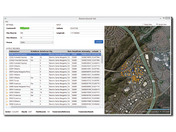
- Convert lat/long coordinates to a physical street address (reverse geocoding)
Try GeoCoder
GeoCoder converts addresses and zip codes into coordinates at the Rooftop, ZIP+4, and ZIP level.
3 Levels of Geocoding Accuracy: Rooftop, ZIP+4, and ZIP Code
GeoCoder provides latitude and longitude geographic coordinates, census tract and block numbers, as well as county name and FIPS numbers.
1. Rooftop Level Geocoding
+Rooftop Level Geocoding translates addresses into latitude and longitude coordinates to know exactly where they are, on a map, in a neighborhood. As the highest level of geocoding available, the accuracy literally comes down to your customer’s front door. The ideal solution for insurance and tax jurisdictions, risk exposure analysis, and delivery routing, Rooftop Level Geocoding is the most precise you can get.
So, how do we do it? Accurate geocoding algorithms are the key to location intelligence. Because address databases are often filled with errors, typos, and inconsistencies, it’s sometimes difficult to match stored data with actual coordinates. Melissa combs through 195 million individual addresses and utilises precise mathematical location algorithms and street shape maps to select the best recorded point. GeoCoder incorporates data from multiple sources, including spatial data, navigational data, and census data. All sources are evaluated and intelligently merged to produce the most precise coordinates possible.
2. ZIP+4® Geocoding
+The next level of accuracy is to the ZIP+4 – which includes an area of about 10-20 households. Even though ZIP+4 geocoding validates the address data with slightly less accuracy than the rooftop level, you can still easily spot demographic and segmentation patterns to target your customers more effectively and power store locators for your business.
3. ZIP Code™ Geocoding
+The broadest range of geocoding is ZIP Code level, which can show you the geographical area and city boundaries. ZIP Codes at this level are mainly used for USPS® sorting, but it can also help you see the general area where your customers are located to plan local or geographic-based marketing campaigns. With ZIP Code level geocoding, you’ll see coordinates usually within a few miles.


International Geocoding
Melissa offers accurate address geocoding for over 240+ countries worldwide. The output points can be visualised on a map, inserted as stops for a route, or loaded as input for spatial analysis. Because addresses around the world are not all the same, the best way to ensure you’re getting reliable geocodes is to utilise Melissa address verification at the same time to ensure your data is accurate and the addresses are real. Click here for a list of all supported countries
Reverse Geocoding
Reverse geocoding works like regular geocoding—but it takes latitude and longitude and converts it to a mapped address. Imagine you have a GPS signal with latitude and longitude coordinates, and you want information about the place represented at this address. The reverse geocoding converts the geographic coordinates into a verified address, which then can be used, for example, to locate a person in case of an emergency. Moreover, it can also be used by companies to create targeted mailing lists containing addresses from a specific geographic area.
- Translate GPS signals into exact addresses for location-based services, applications, and precise vehicle tracking
- Expedite emergency and relief efforts by knowing exactly where to send help
- Push real-time, geo-targeted marketing messages to mobile audiences who are ready to buy now


Request a Demonstration
A demonstration with one of our representatives gives you a first-hand look at our products in action. Request one today.
Request Demo NowHelpful Resources


